


Can-Am Outlander 850 DPS Pt 2: Garmin Tread 2, An Important Add-On

You can’t get far if you don’t know where you’re going!

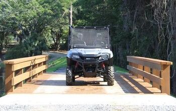
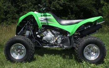
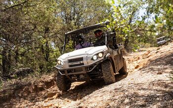
I’d hoped to add a few accessories like a plow/winch combo to the 2025 Can-Am Outlander 850 DPS over Christmas break, but except for a dumping on Christmas Eve, we haven’t had any powder to speak of! So, what else does a bike need to start out? The 850 already has a box, so the next important thing is a GPS.
A few weeks back, I received a Garmin Tread 2 in for testing. Their new satellite navigation builds on the success of the earlier Tread and XT models, with a lot more bells and whistles than the older handheld devices that most of us started our off-road careers with. While the Tread series is very similar to the XT lineup, the XT units are meant more for street usage, while the Tread 2 is built to be mounted to your vehicle for backcountry exploration.
It’s packed with new features, including turn-by-turn routing down trails and forest roads, and satellite maps are available without a subscription. Here’s my experience with this unit ($699 MSRP) so far.

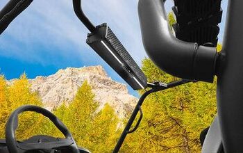
The Garmin Tread 2 Was Easy to Install
The Tread 2 will run for hours off its onboard battery, but it’s designed to be wired into your ATV’s electrical system. Every machine is different, so your process may be different than mine. Some users might want to wire directly to the battery, while others may prefer to tap into the wiring harness with a Posi-Tap or find a factory-installed switched plug that’s available. In my case, the Can-Am has terminals under the seat to connect to, all very accessible.
Garmin provides a wiring harness, complete with an inline fuse, that runs from the unit’s charging cradle to your power source, along with a set of ring connectors. I crimped the ring connectors to the harness and then attached them to the terminals under the seat. I threaded the wiring harness under the bodywork and up to the handlebars, where I mounted the Tread 2 with a RAM mount that I pinched off my motorcycle. Garmin provides their own ball-type mount in the packaging, but I found my other one fits the handlebars better. Your mileage may vary, depending on what ATV you’re installing the device on.
There’s enough real estate on the handlebars that it wasn’t too hard to get the Tread 2 installed on the Can-Am 850 Outlander DPS in a position that allowed me to easily see while riding.


Using the Garmin Tread 2
A GPS tells you where you are, where you’re going, and how to get there. For that, you need maps.
The Garmin Tread 2 uses satellite positioning data from the GPS and Galileo networks. The device comes with City Navigator street maps installed (yes, you can use this on your street motorcycle or car, too). It also has OpenStreetMaps data for dirt roads or trails, as well as US Forest Service Vehicle Use maps, the Garmin Adventure Roads and Trails map data, along with other topos and forestry map data, and even campsite location data. There’s also information specifically for snowmobiles, detailing routes that might only be open when water bodies and swamps are frozen.
I’m familiar with most of the ATV trails on public land around my house and was happy to see most, but not all, were included on the Tread 2’s preloaded maps. For those that weren’t, the Tread 2’s satellite imagery capability came into play. Using this imagery, you can spy the openings in the woods where your trail runs, even if routable data for that track isn’t in the system already.
I was most impressed with the Tread 2’s ability to download satellite imagery without requiring an expensive subscription service. I’ve used this out in the woods when I know roughly where I am, but I want to know for sure where I fit in the big picture and where the rough trails that aren’t on the official maps will lead me.

The preloaded maps include boundary information for BLM land, U.S. national forests, and private land boundaries, including landowner information for properties bigger than four acres. This can be a big help if you’re looking to gain access to new riding grounds and need to know how to contact the owner.
Along with all this free map data, you can also purchase a subscription to Outdoor Maps+ if you need more information like slope angle, avalanche risk, and so on. Westerners in the mountains will find this more useful than a swamp-dwelling easterner like myself.
If you’re riding with friends, you can share GPX files with them or track their machines in real time via the Tread 2’s Group Ride capability. Obviously, they must also have a compatible device, and the system also requires a Wi-Fi or data connection to work. In other words, if you’re near a cell tower, you can do it, but it won’t work if you’re a hundred miles away from civilization and mobile networks.

If you want to design a route to follow on your GPS or otherwise interface with the maps on your Tread 2, you need to get comfortable with Garmin’s no-charge Tread app, available for Android and Apple devices. In the past, Garmin users managed routes, waypoints, and tracks with a computer using the Basecamp app. While Basecamp can interface with the Tread 2, Garmin says you should use the Tread app.
This might mean you have to learn new software, and the most frustrating point of Garmin’s universe has always been learning the software that works with the hardware. The Tread app is fairly intuitive, but it will still require a learning curve. Some users complain that their GPS routing changes between the points of their route, while others don’t like the importing process. Personally, I used the Tread app on my large-screen tablet (Samsung Tab S7+) and had to re-learn the process of designing routes, but I didn’t have any major difficulties. Using this premium mobile device meant more computing power and a bigger screen, which helped make it easier for me.
Using the Tread app, you can design your own turn-by-turn routes or download others’ work. Once you’re out on the trails, the Tread 2 will send a voice command over the speakers if you’ve connected a helmet comm set, so you don’t have to keep an eye on your GPS screen constantly when you’re riding.

When you’re out on the trails, the Tread 2’s touchscreen is responsive (it even works with some gloves), and the menus are easy to navigate. There’s a built-in weather and weather radar app, a traffic app, a track recording app, and a music player app (controlling MP3s loaded to the Tread 2’s hard drive, on an SD card, or controlling your phone’s music). There are also controllers for your light bars, sound system, or video cameras, provided they are wirelessly compatible with the Tread 2. That’s handy stuff if you’ve got GoPros that aren’t easy to reach while you’re riding.
Depending on what helmet comm you’re using, configuring the music playback function to work smoothly may take some figuring out. I’ve had this issue with other Garmin GPS devices, and the key is usually to pair everything by Bluetooth in a certain order. I did have some problems connecting an old Sena 10U comm, and my Sena 50S had trouble controlling music playback. As I said, the solution is to just un-pair and pair devices until you’ve satisfied the electro-brain and it recognizes your phone and comm correctly.
When you’re riding, the Tread 2 has an altimeter (again, something more useful out west than here in the eastern lowlands) and a pitch-yaw gauge that helps you keep your ATV right-side up. If you want to mount your GPS device in the dash where it’s difficult to reach, or if you just want to simplify your control of the unit while riding, there’s a new wired-in handlebar controller from Garmin ( MSRP $149.99). This lets you interface with the menus without actually touching the screen. If you ride wearing gloves, this could be handy.

Built to last
The Garmin Tread 2 appears to be a tough piece of kit. The case has angled edges so the screen doesn’t crack if it falls. It also has a MIL-STD-810 drop-proof rating and is IPX7-waterproof and IPX6 dustproof. The cradle appears tough enough for the task. I haven’t been able to get the Tread 2 to pop out of its holding bracket yet.
The charging connection inside the cradle appears to be the weakest point of the design. The pins appear to be the same design as the previous XT unit. I managed to break those after a couple of seasons of use, and I wasn’t being hard on it. However, the Tread 2 also has a USB-C port, and the power cables to the charging cradle have a USB power outlet. Garmin does not recommend you use this to keep the GPS charged up, but I think it might work in a pinch, although perhaps it’s not waterproof.


Who is this for?
A lot of Powersports enthusiasts have turned to cellphone apps for navigation these days, so why buy the Tread 2? First, I think you’re better off with a dedicated, built-tough navigation device with a bright screen built for the job (5.3x3 inches, 6-inch diagonal). The device comes with tons of useful map data built-in, and you can easily download more. It’s made for navigational use in all weather, unlike your cellphone. It’s also made to keep mud, dust, and other mess at bay, while that crud could kill your cellphone if it’s on your handlebars.
If you want a tough navigation solution, this should work for you, helping you have more fun on the trails and out in the wilderness. If you can afford the $699 and want to expand where you go and what you do on your ATV, it’s well worth checking out.


Professional hoser. Raised by wolves on Prince Edward Island. Now living in the wilderness of Charlotte County, New Brunswick. Lover of internal combustion engines.
More by Zac Kurylyk


![More ATVs on Ice [video]](https://cdn-fastly.atv.com/media/2022/10/24/8742964/more-atvs-on-ice-video.jpg?size=350x220)


Comments
Join the conversation