
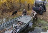

LNKT Live Location Sharing is your Link to Help in your Time of Need

When we are trail riding or hunting in the outdoors, we often are not close to home. Quite the contrary, we are in the backwoods somewhere far from help. So, in the rare event that something should go wrong, you don’t want to be metaphorically and literally alone. That is exactly why the LNKT app was developed: to keep people in touch with loved ones and emergency services when they may need it.

LNKT - Stay Close yet Go Far
The founder of LNKT, Tony Jenniges, created this product because of a situation he was involved in, unfortunately. His own father suffered an injury and if not for knowing exactly where he was located, that day could have ended much worse. What Tony understood that day is that this occurs all too often. We are strong, resilient individuals, but a bad day can happen to anyone. Then, what? LNKT can be your connection to help that you never thought you would need.
- Custom Safety Areas with Automated Alerts, Unlimited Waypoints and Trails: Draw freeform trails, drop unlimited waypoints, and set an adjustable geofence on any point or trail so LNKT automatically alerts a contact the moment you arrive or leave with messages like “Tony has arrived at North 80 tree stand” (no manual check-ins required). Waypoints from other apps can be imported.
- High-Definition Mapping: Recent, ultra-high-definition satellite imagery with optional terrain, street, LiDAR hillshade, public-land boundary and U.S. landowner layers, plus interactive 3D maps. Perfect for scouting.

- Group Sharing: Share waypoints, trails and automated safety alerts with an entire group at once (like a hunting camp), with alerts working across the group automatically.
- Last Known Location: If a phone dies or loses service, LNKT marks that person’s last known location.
- MTN Mode: Built for the backcountry, MTN Mode drops waypoints and maps a route as the user moves, even offline, then syncs everything to a chosen contact the moment the slightest signal is detected.

A Word from LNKT on their Location Sharing Map Service
Kearney, Nebraska - September, 2026 - LNKT Inc. today announced the launch of LNKT, a realtime safety and mapping app built for people who spend time outdoors and the people back home who care about them. LNKT combines feature-rich mapping and planning tools with automated safety alerts that share a user’s location, mark the places that matter and keep family and friends informed as they come and go.
“I built LNKT because my family learned how quickly a normal day outdoors can become an emergency,” said Jenniges, founder of LNKT. “My dad fell from his treestand and was badly injured, and I was the only person who knew exactly where he was and how to get EMTs and the helicopter to him. I’ve replayed that day more times than I can count — what if he couldn’t reach his phone, or I hadn’t known where that treestand was? LNKT was built so another family doesn’t have to face those questions.”

Before Hitting the Trail
After beating the rat race of our 9-5 on weekdays, it’s always nice to get outside and enjoy the outdoors. Whether you are hiking, trail riding, or putzing around on your own property, you don’t want a leisurely day in the field to turn treacherous by not being prepared. The LNKT app looks to have you always prepared.
This new app is available now for Android and iOS. It’s free to download, with a premium tier offered at $9.99 per month or $99/year. To learn more about the app, its features and applications, visit LNKT.


I am the Editor-at-Large for Carbon Media (AllOutdoor.com, OutdoorHub.com, TheFirearmBlog.com, TheTruthAboutGuns.com, ATV.com, Off-Road.com). When I am not testing firearms or hunting, I am the Mayor of my hometown in St. Joseph, MN. I also am a writer for TheArmoryLife.com (Springfield Armory) as well as a Smith & Wesson and Glock Certified Armorer, Firefighter, and 1st Responder.
More by Adam Scepaniak




















Comments
Join the conversation